#
#
Building Connected Communities Through Spatial Thinking
Pozi combines geographic information from local data sources and trusted web services to give your users the complete picture.
Deploy for a fraction of cost of traditional GIS software, with no lock-in contracts.

#
Confident decision making
Empower your users with the critical information they need by integrating with live, authoritative data sources

#
Ease of use
Simple, modern map interface with a focus on immediate usability

#
Real Support
Our team works with you to customise and maintain your map application - you're never on your own
#
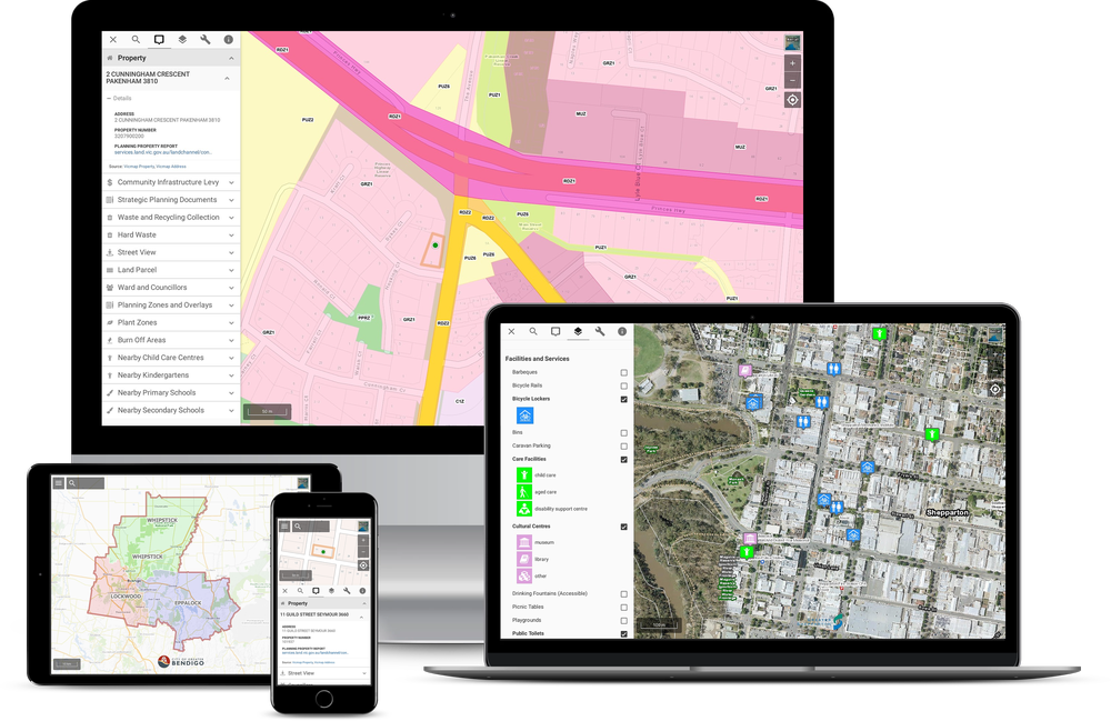
Visualise & interact with location-based information in a simple map interface
#
What our clients say...
"We see great online traffic data and know visiting the website has become a key part of customer service interaction. The waste and recycling collection widget is one of the most popular pages on our website."
Cardinia Shire Council
"Really appreciate the 5 star support. So helpful and fast to respond. Thank you!"
Strathbogie Shire Council
"The Pozi mapping product is a great tool to easily display public map-based information for users. The process, design and planning stages are made simple by the Pozi Support team."
Rural City of Wangaratta
"The clean look and layout of Pozi, along with its user friendly functionality make it easy for customers to locate and interpret data. It's an efficient tool for delivering information to our customers, and the staff at Pozi provide great support to their clients."
Latrobe City Council
#
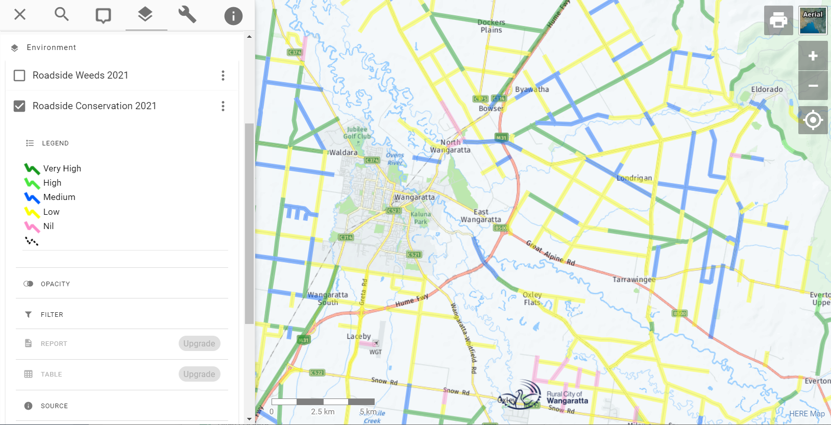
Powered by QGIS
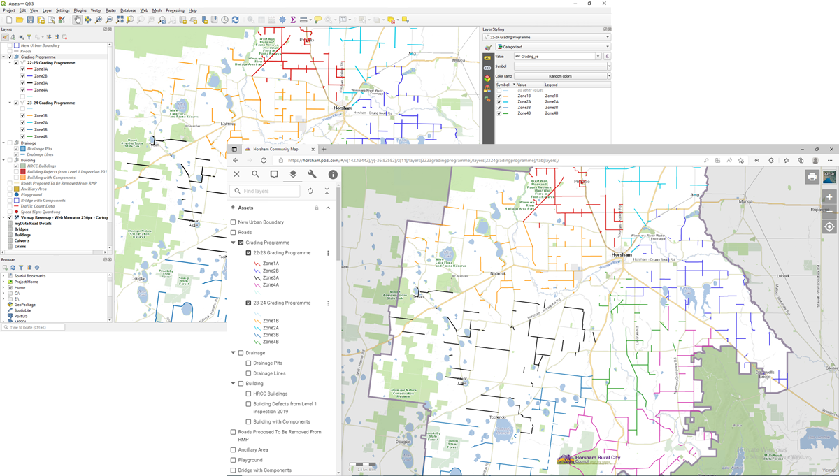
Use QGIS to configure your layers in Pozi, including adding data sources, layer styling, filtering, data joins, metadata, nested groups, and more.
#
Showcase
![]() Glen Eira City Council
Glen Eira City Council
![]() Frankston City Council
Frankston City Council
![]() Cardinia Shire Council
Cardinia Shire Council
![]() City of Greater Bendigo
City of Greater Bendigo
#
Why Pozi?
Pozi is your new geospatial enquiry solution for organisations who need to:


Make timely and informed decisions about infrastructure, properties and workforce
Help customers with their location-based enquiries
Promote local places, facilities events and services to customers
Pozi is an intuitive, interactive, location-based communication platform for your internal and external users that aggregates geographic information from multiple sources in an simple web interface, at a fraction of the cost of traditional Geographic Information System (GIS) software.
#
Ultimate connectability
Eliminate data double-handling by accessing data directly from any local or remote source
#
Benefit from a hosted web map that...
✔️ Displays location-based information and data from multiple sources in one map window
✔️ Creates maps for enquiries, visualisation and fieldwork
✔️ Integrates existing systems and software easily at lower cost
✔️ Customises to your unique data
✔️ Eliminates expensive software licensing fees and doesn't lock you in to a long-term contract
#
Pozi features...
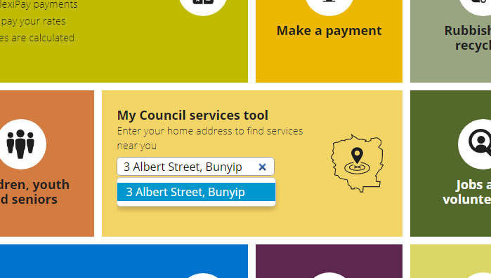
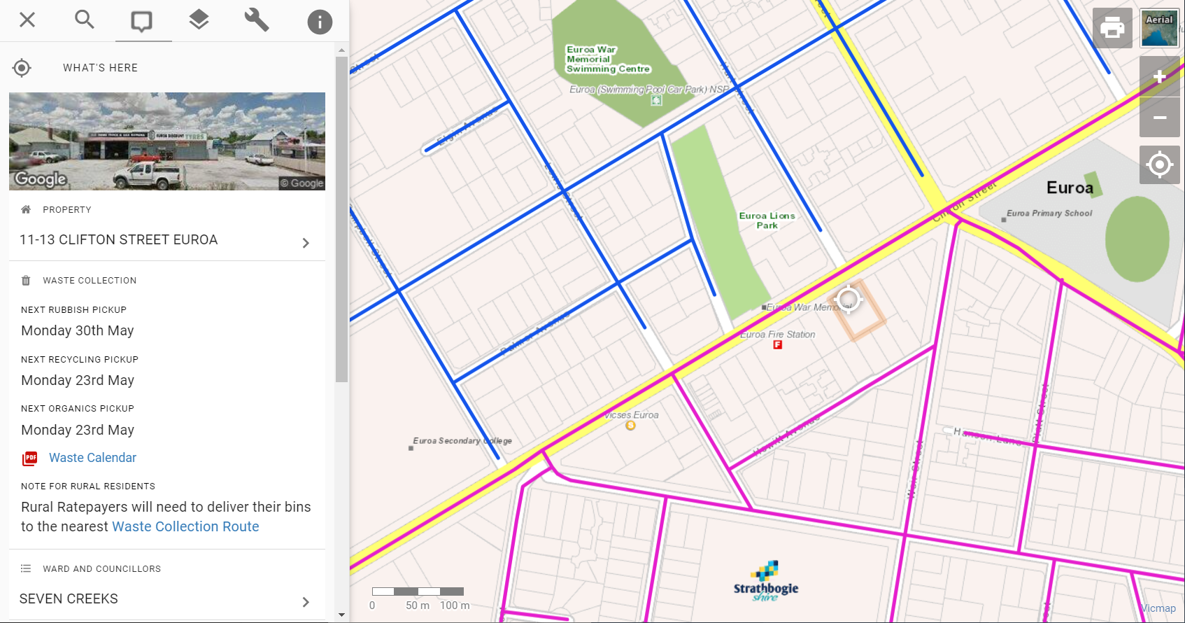
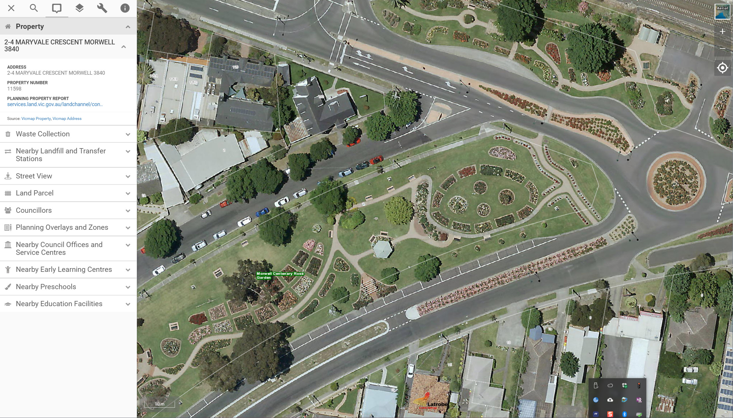
Deliver data to staff and public – easily and affordably. Users can access the information they need at any time, such as property information, nearby community facilities and services, and aerial imagery.
✔️ Manage services intelligently - Staff can view additional information such as property owner details and asset information
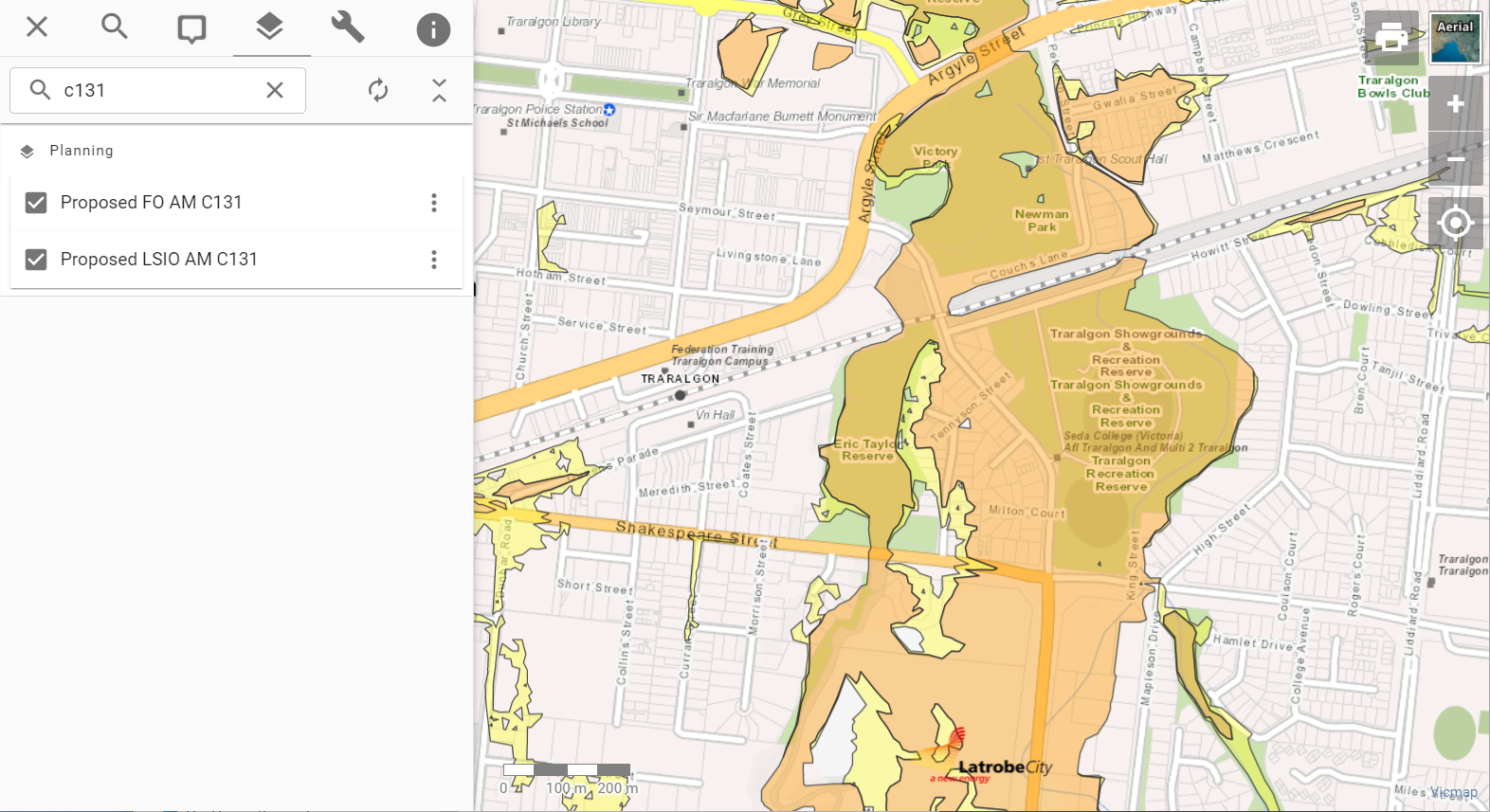
✔️ Find information about any location - View land parcel details, planning controls, road closures, maintenance schedules, major projects, waste collection zones and more
✔️ Reduce data maintenance overheads - the Pozi app operates independently of your internal IT infrastructure and connects live to state and federal government web services so you don't have to spend time maintaining and updating background datasets
#
Let's get technical...
Pozi is served from a secure Australian-based web host. This means you get all the benefits of cloud computing (security, backups, disaster recovery and continuous upgrades) and ongoing support.
✔️ Responsive design for desktop, tablet and mobile devices
✔️ Bookmarking of locations, layers and features for sending links and embedding custom maps in your website
✔️ Integration with internal and external sources to display vital information for any location
✔️ GPS location to place your staff and customers at the scene
✔️ Customisation so your organisation can get up and running quickly
#
Let's get functional...
Deliver data to staff and public – easily and affordably. Users can access the information they need at any time, such as property information, nearby community facilities and services, and aerial imagery.
✔️ Display map information from different sources on the one map
✔️ Have full visibility of your organisation's activities through a single portal
✔️ Free your people to use data strategically with no need to double-handle externally-maintained data
✔️ Share information cost effectively and connect with staff and public
✔️ Deliver relevant data to external stakeholders on demand
✔️ Customise maps display with just one click
#
GIS solutions since 1999
For over twenty years, Pozi (formerly Groundtruth) has helped organisations to work more efficiently and gain greater insights into their clients, resources, activities and risks by making use of location-based information in their business processes.
#
Get in touch
Contact us to discuss a free, 60 day Pozi trial or for a friendly chat about how we can work with you to deliver your organisation's needs.